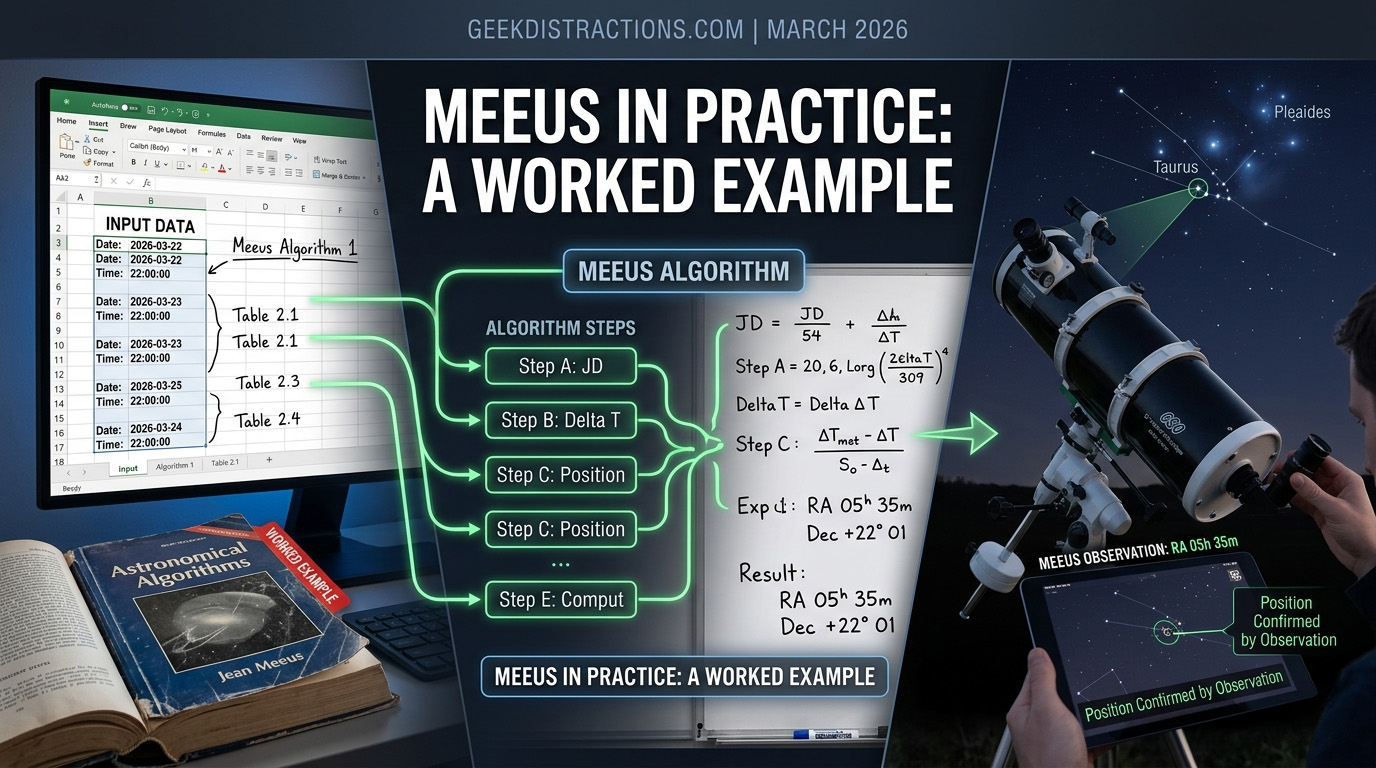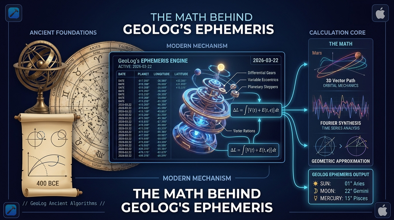
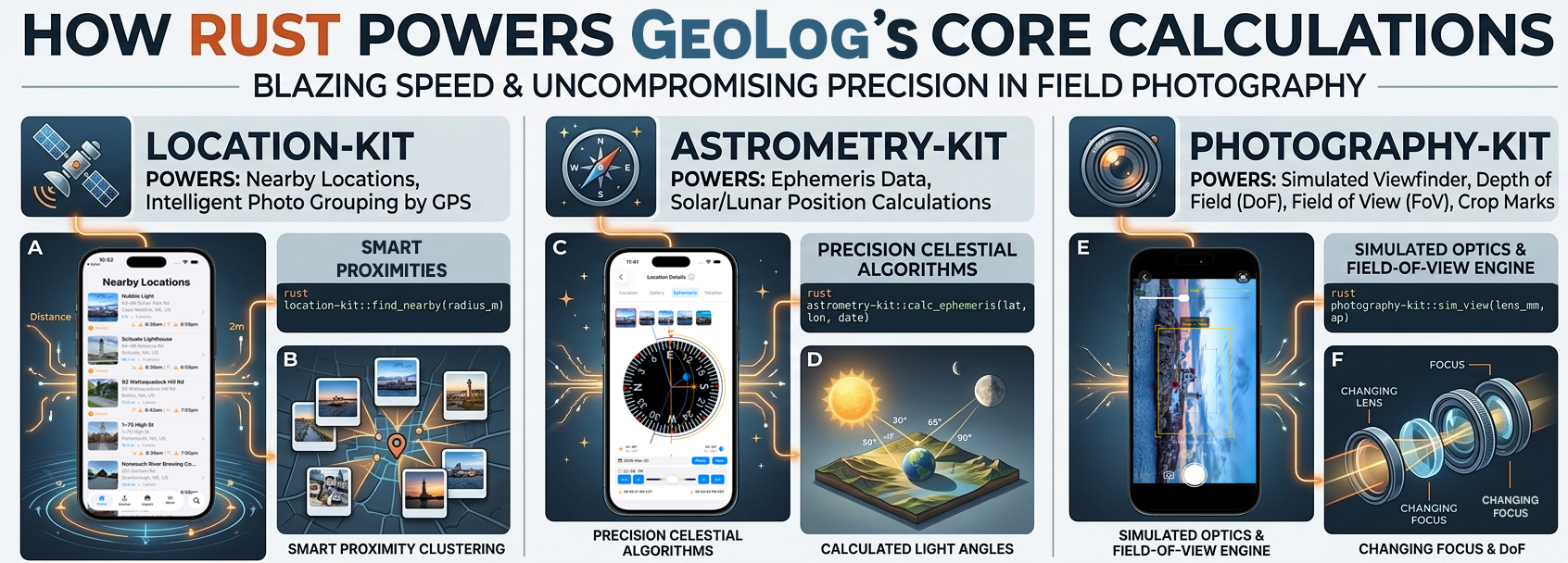
Introduction
GeoLog started with a simple premise: what’s near me right now? Every feature in the app flows from that question — the gallery sorts by proximity, the nearby locations list updates as you move, and the whole workflow is built for the moment before you grab your gear and head out the door.
That premise worked fine early on. Then my test library grew past 100 locations, and I started noticing something on my iPhone 11 test device: the Nearby Locations list was getting sluggish. Not broken — just slow enough to feel wrong.
The naive approach — sorting by latitude and longitude directly — doesn’t actually measure distance. It’s fast, but it’s wrong. A degree of longitude in Texas is not the same distance as a degree of longitude in Alaska. The app’s entire reason for existing is proximity, so sorting by proximity correctly isn’t optional. I needed geodesic distance calculations — the real math — running fast enough that a growing location library wouldn’t penalize the user.
That’s what led me to Rust.
(more…)